
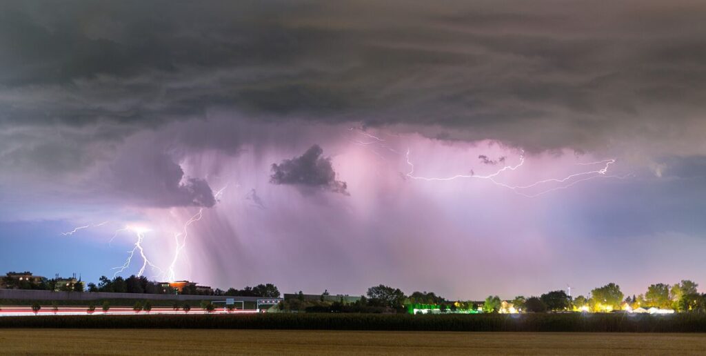
Most wildfires in remote forests are started not by people but by lightning, often from storms that produce dramatic electrical displays and almost no rain. Fire scientists are now combining satellite lightning detection, atmospheric modelling and detailed maps of fuel dryness to forecast not just where storms will occur but where their strikes are likely to ignite fires that smoulder undetected for days. The problem, known to crews as holdover fires, is that a strike can bury heat in a tree stump or deep litter layer, emerging as open flame only when wind rises and humidity falls. New forecast systems score landscapes by ignition probability, allowing agencies to position cameras, aircraft and crews before the first smoke report. In test seasons, the highest-risk zones identified in advance contained the large majority of subsequent lightning fires, a result that has convinced several fire services to build the tool into their daily planning alongside conventional weather briefings.
What the Evidence Shows
The science behind the forecasts draws on a better understanding of lightning itself. Researchers have found that the electrical character of a strike, particularly long-lasting continuing currents, strongly affects its chance of starting a fire, and modern detection networks can measure those properties in real time. Climate change is complicating the picture by drying fuels earlier in the year and pushing thunderstorms into regions and seasons with little lightning history. Ecologists add nuance: lightning fire is a natural process that many ecosystems need, and the goal of forecasting is not to suppress every ignition but to protect communities and choose, deliberately, which fires can be allowed to perform their ecological work. That decision requires lead time, which is exactly what the new systems promise. As detection improves, the same data may refine insurance models, power grid operations and the design of early warning systems for the public in fire-prone regions. Reporting and analysis from sources such as Nature track the same developments, and specialists following lightning forecasting for wildfire ignition risk say the direction is now consistent across independent lines of evidence.
The Wider Context
The wider context is a research landscape in which replication and open data now decide reputations. Findings connected to lightning forecasting for wildfire ignition risk are being checked by independent groups with shared datasets, and the teams involved publish their methods in full so rivals can test every step. That discipline is slower than a headline cycle, but it is why results in this area increasingly survive first contact with scrutiny.
What Happens Next
What happens next in the story of lightning forecasting for wildfire ignition risk will be decided by follow-up work already under way: larger samples, longer observation and instruments that have not yet come online. The researchers involved are unusually united on one point, that the current results justify the next investment of time and money. Readers will not have to wait long for the first tests of that claim. You can follow related developments in our coverage of science.
None of this will be settled by a single announcement, study or product launch. The pattern to watch is accumulation: independent confirmations, honest reporting of failures and steady improvement in the underlying numbers. Readers who follow those signals, rather than the loudest claim of the week, will understand this subject better than most of the commentary surrounding it suggests is possible.
